Niceto Pérez (Niceto Perez)
Niceto Pérez ist ein Municipio im Südosten Kubas und gehört zur Provinz Guantánamo. Das administrative Zentrum ist die Ortschaft La Yaya.
Das Municipio Niceto Pérez hat eine Gesamtfläche von 632,64 km². Es besitzt im Süden einen schmalen Zugang zur Karibik bzw. dem Atlantischen Ozean. Die Provinz Santiago de Cuba bildet die östliche Grenze. Das Municipio El Salvador schließt sich im Norden an, die Provinzhauptstadt Guantánamo im Nordosten und im Südosten das Municipio Caimanera.
Das Municipio Niceto Pérez hat eine Gesamtfläche von 632,64 km². Es besitzt im Süden einen schmalen Zugang zur Karibik bzw. dem Atlantischen Ozean. Die Provinz Santiago de Cuba bildet die östliche Grenze. Das Municipio El Salvador schließt sich im Norden an, die Provinzhauptstadt Guantánamo im Nordosten und im Südosten das Municipio Caimanera.
Karte (Kartografie) - Niceto Pérez (Niceto Perez)
Karte (Kartografie)


Land (Geographie) - Kuba
 |
 |
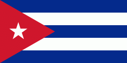
| Flagge Kubas | |
Kolumbus nannte die Insel bei ihrer Entdeckung zunächst Juana nach dem Prinzen Don Juan. Im Jahr 1515 ordnete dessen Vater Fernando II., König von Spanien, die Umbenennung in Fernandina an, denn nach ihm war bisher nur eine Insel der Bahamas (heute: Long Island) benannt worden.
Währung / Sprache
| ISO | Währung | Symbol | Signifikante Stellen |
|---|---|---|---|
| CUP | Kubanischer Peso (Cuban peso) | $ | 2 |
| CUC | Peso convertible (Cuban convertible peso) | $ | 2 |
| ISO | Sprache |
|---|---|
| ES | Spanische Sprache (Spanish language) |